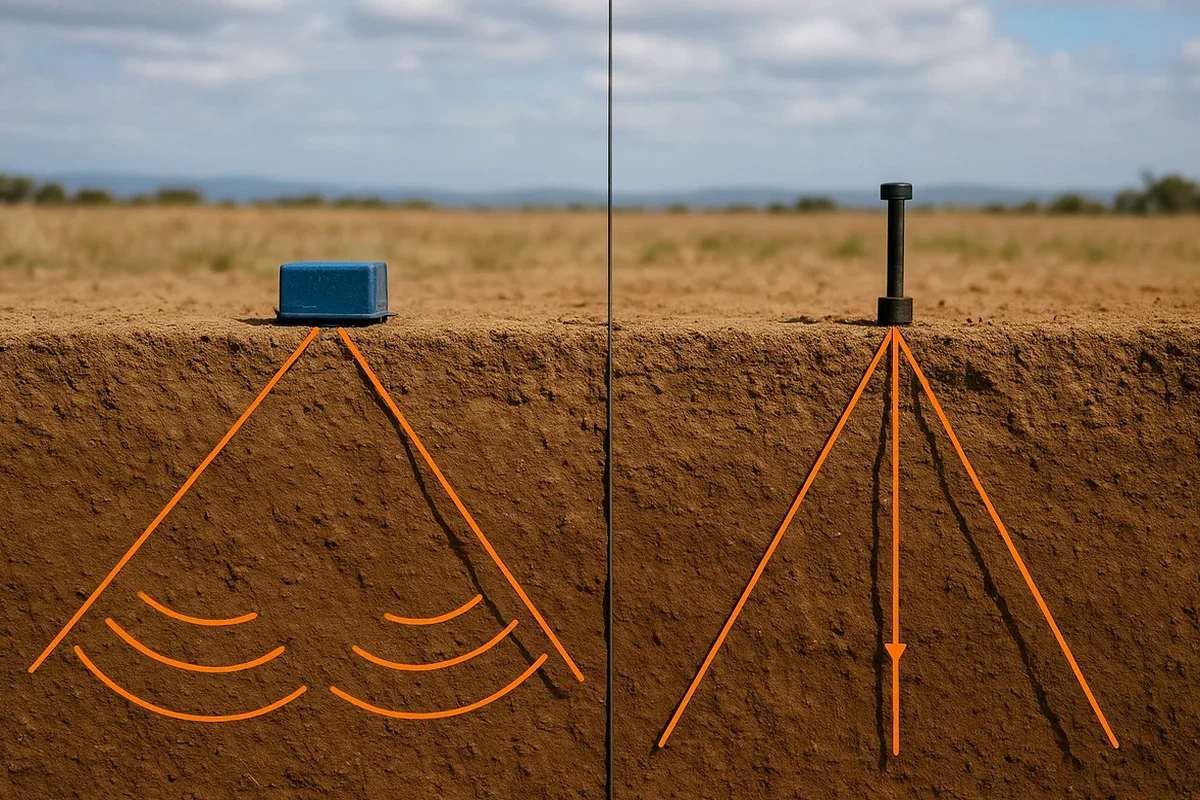
A 24-channel seismograph and a sledgehammer plate — that is our starting point in Fontana. The setup triggers a controlled wave right at the surface. Geophones spaced along the line capture every return signal. We process the first arrivals for refraction and the full wavefield for reflection. This gives you a velocity model of the subsurface. It maps the transition from loose alluvium to competent rock. In a city like Fontana, with its location at the base of the Jurupa Mountains and the deep alluvial fan of Lytle Creek, this contrast is sharp and critical. The data feeds directly into ASCE 7 site classification. Knowing if you are on Site Class C or D changes your foundation cost. A MASW survey can supplement the Vs profile, while grain-size analysis from borings confirms the material description from the seismic response.
A clear velocity contrast map in Fontana's alluvial fan prevents overexcavation and unexpected foundation change orders.